
On the 156th anniversary of the last day of the Battle of Gettysburg in 1863, it seems appropriate to post notes about a recent visit to the battlefield on June 15-16. Unhappily, I didn’t have as much time as I would have liked, but the time I spent there was interesting.
I like walking battlefields and have done so at places like the Somme, Ypres, and the Normandy D-Day Beaches. You get a certain insight from walking over the ground where armies fought that fills in many of the gaps left by even the best description in a book.

Limited Time for a Walk
Because I had limited time, I concentrated on walking the battlefield of July 2 and 3. Compared to the ground consumed by modern conflicts, Gettysburg is a relatively small battlefield, but I still walked 17 km on Saturday afternoon and evening to follow a trail out of town along the Baltimore Pike to the cemetery, to the Taneytown Road, Cemetery Ridge, to Little Round Top, Devil’s Den, the wheat field, the peach orchard, and back to the Angle on Cemetery Ridge before heading back to town via the Leister Farm (the HQ of General Meade, the Union commander) and the artillery positions on top of east Cemetery Hill. Most of the places I visited are accessible by car using National Park or public roads, but you see so much more when you walk from place to place.

The best views of the battlefield are from the top of the Pennsylvania monument or Little Round Top, where a statue of Gouverneur Warren overlooks much of the ground fought over on July 2 and 3. Given the terrain, it’s easy to see why the fighting was so difficult and intense around Devil’s Den, Little Round Top, and the wheat field on July 2, especially the kind of close-quarter fighting made necessary by the limited range and accuracy of the available weapons.

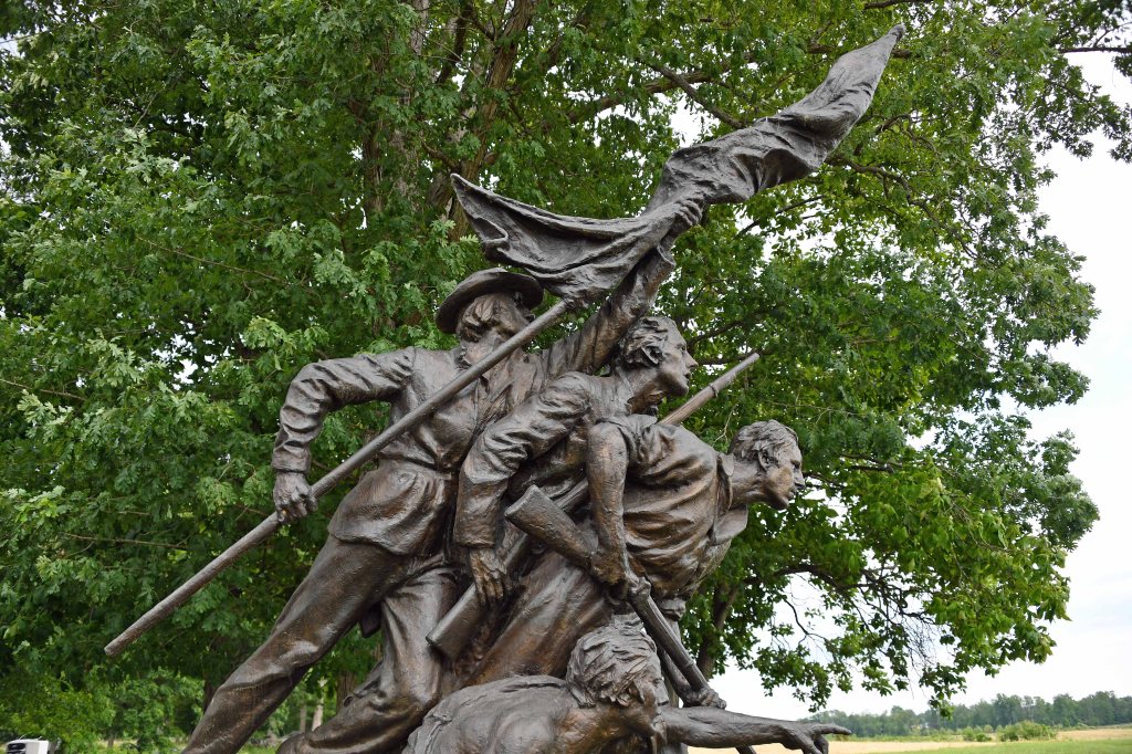
Looping around to the Peach Orchard and the Emmitsburg Road, the view of the ground that the Confederates attacked over on July 2 and 3 opened up. I was especially taken by the number of folds in the ground that served to hide attackers or defenders from direct fire. Just past the Codori Farm, you can come off the road to walk across the ground leading up to the famous “Angle” and “Copse of Trees” that mark the maximum penetration of the Confederate troops in Pickett’s Charge on July 3. This Smithsonian project helps people visualize what troops could see on the ground during the battle.
The Final Slope of Pickett’s Charge
Although the Confederate troops were under sustained fire from cannon and Union skirmishers for quite a long time, the effect of musket and rifle fire only took effect after they moved across the fences at the Emmitsburg Road towards the low stone walls that marked the Union line. The distance varies because of the way the road and wall are laid out, but most would have had to travel 200 to 250 metres across bumpy ground up a slope to where the defenders waited. Walking briskly from the road to the wall took effort; running or charging complete with battle equipment into lines of defenders firing at you (including cannon firing canister over open sights) took more courage than I can comprehend.
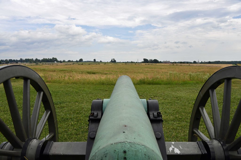
The next day I was even more limited for time as I had to get back to Dulles for a flight back to Ireland. I visited the excellent National Park Service Museum and then drove to the Virginia Memorial on Seminary Ridge, at approximately the point where Robert E. Lee watched Pickett’s Charge. You can walk out towards the Emmitsburg Road from this point to reach a line of cannons and see the ground over which the Confederates advanced in the early part of the charge. Once again, you get a view of how the land undulates with places where troops are hidden from attackers for a time before they emerge again under fire.
Recreating the Battle
Around the battlefield you might meet people dressed in Union and Confederate uniforms like the gentleman shown below who was helping visitors to the Virginia memorial understand what happened there. Every year, people come together to reenact the battle over three days, all of whom are dressed as accurately as possible. The reenactment doesn’t happen on the actual battlefield; its site is a few miles away.

Books to Read
Even though my time in Gettysburg was limited, I got a lot out of the trip, probably because I read several books beforehand. These are the ones that I found most interesting:
- A Field Guide to Gettysburg, Second Edition: Experiencing the Battlefield through Its History, Places, and People by Carol Reardon and Tom Vossler (Good guide to the locations).
- Gettysburg: The Last Invasion (Vintage Civil War Library) by Allen Guelzo (nice coverage of the battle as a whole, including the military conditions, and my favorite book on the topic).
- Gettysburg: The Final Fury by Bruce Catton.
- Jeff Shaara’s Civil War Battlefields: Discovering America’s Hallowed Ground by Jeff Shaara
During my visit, I enjoyed visiting some of the antiques stores, notably the Horse Soldier. Go there if ever you want to see a collection of civil war muskets, rifles, swords, and pistols outside a museum. Regretfully, it wasn’t possible to take one of their muskets home to Ireland (Aer Lingus and the Irish Government don’t like that sort of thing).

Leave a comment